
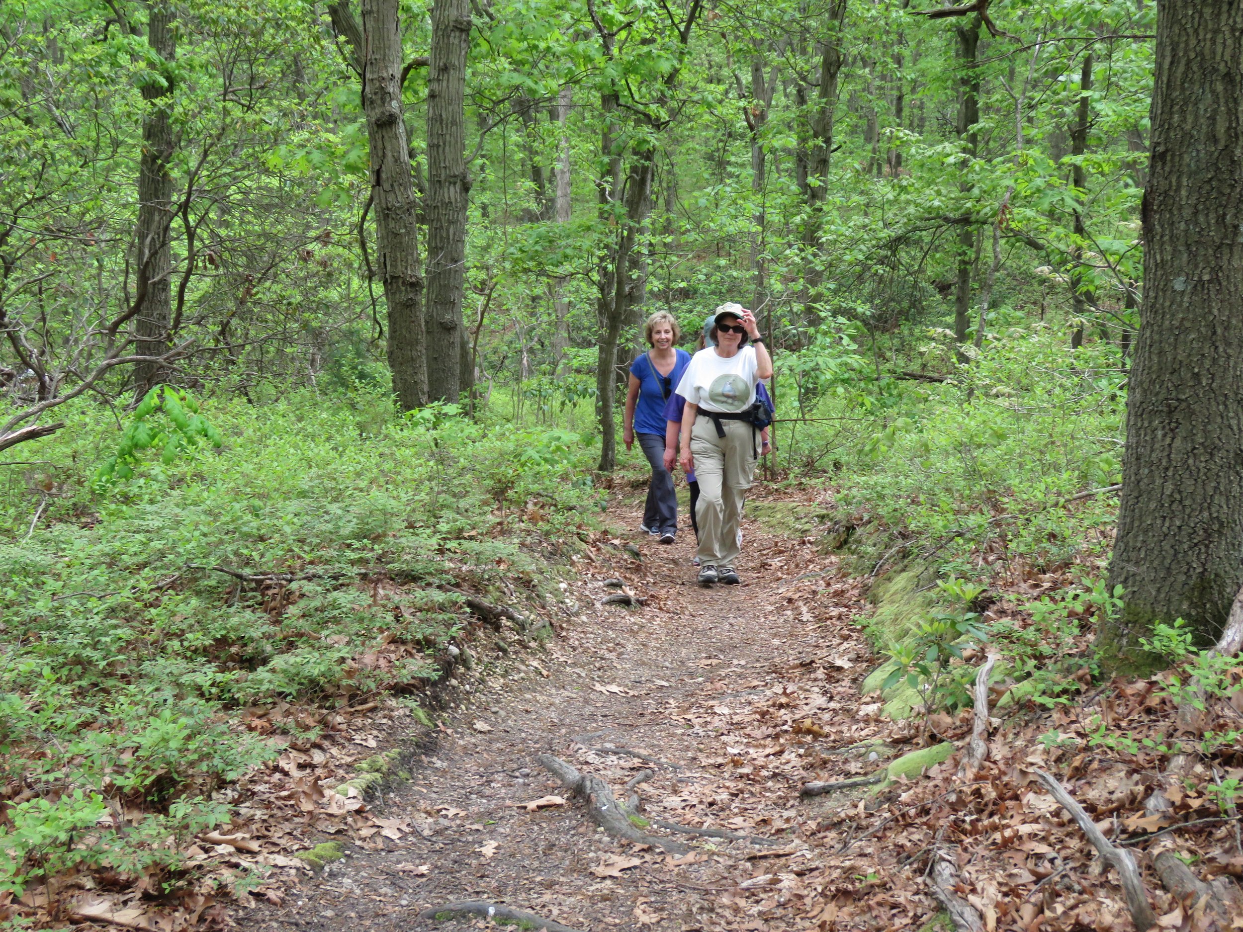
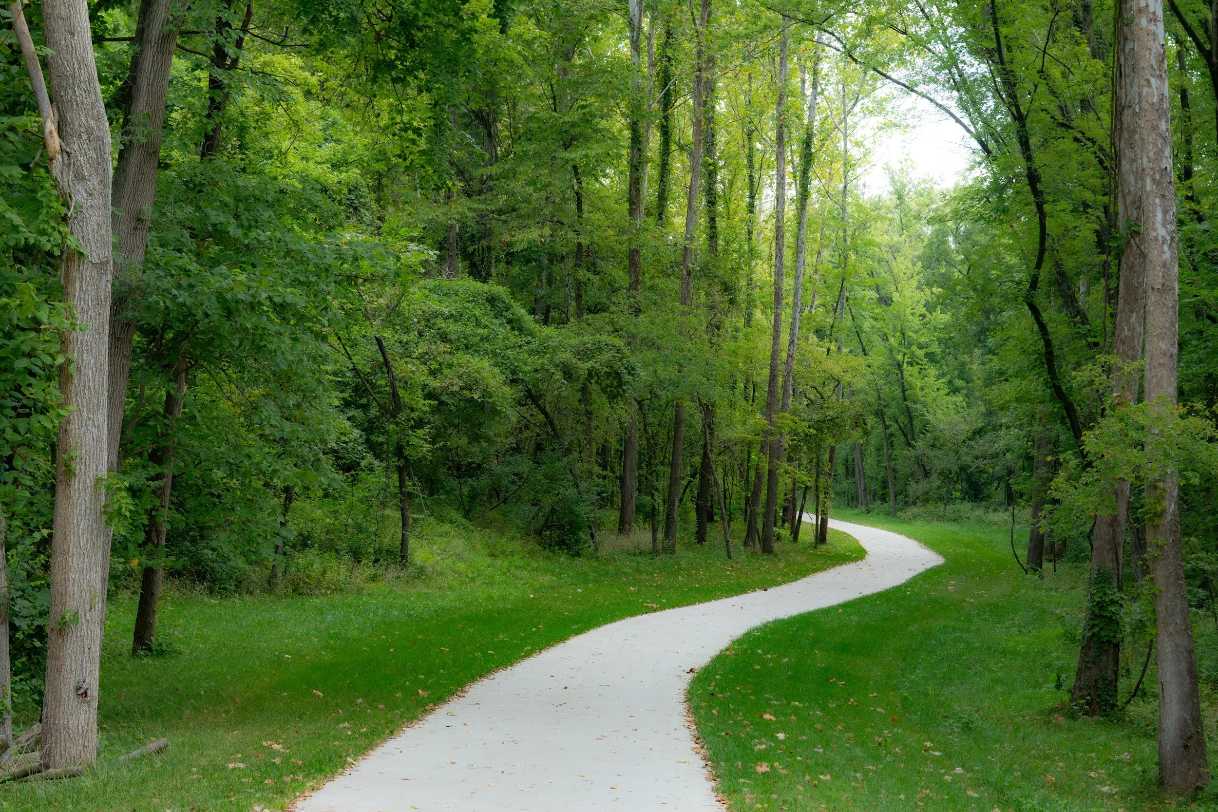
Join us for a hike.
NISSEQUOGUE RIVER TO SUNKEN MEADOW
8.5 mile or 10.5 mile options - 1050ft Elevation Gain - Moderate to Strenuous Difficulty - 3 MPH pace - Call or Email: Mark, QuistAdventures@gmail.com, 516-672-9853. Come roam Nissequogue River State Park and the grounds of the former Kings Park Psychiatric Center as we head towards Sunken Meadow State Park and loop back. We will start by following the Long Island Greenbelt Trail into the Bluffs, and to Sunken Meadow State Park where we will explore the eastern and southern trails, before looping back and walking the paved paths of Nissequogue River State Park. Plenty of water and snacks are strongly recommended. Pants highly recommended this time of year. Heavy rain cancels. If unsure, please contact me on the morning of the hike. There will be no fee for entering the parks as we are parking outside of them. Address : 213 Kings Park Blvd. Kings Park, NY 11754. Hike end time is approximate.
TERRELL RIVER / KALER'S POND PARKS
4–5.1 miles. PRIOR Registration and cellphone number required - CALL Sal, 631-235-2059, or E: sailingsals60@gmail.com. A moderately fast hike over gently varied terrain paralleling the river, opening to a picturesque beach with scenic views of Moriches Bay and Fire Island National Seashore; after hiking along the beach we will return to the trails to complete the loop; hiking shoes recommended; bring ample water, snacks and a smile; binoculars/cameras for wildlife viewing optional. from L.I.E. Exit 68 or NY 27 Exit 58S, take William Floyd Parkway south to Montauk Hwy. (C.R. 80); turn left, and in 2.9 miles keep right to stay on Montauk Hwy.; continue another 2.1 miles to Kalers Pond Park parking lot, on left, opposite Terrell River Park. GPS: 1 Chet Swezey Rd, Center Moriches, NY 11934. No parking fee. Heavy rain cancels, light rain does not. Optional lunch afterwards. Hike end time is approximate.

BAYARD CUTTING ARBORETUM
4.5 to 5 miles – PRIOR Registration and cellphone number required - CALL or E: Sal, 631-235-2059, or sailingsals60@gmail.com. Meet at the new Welcome Center/ Restrooms for a brisk hike in this South Shore hidden jewel encompassing 690 acres along the picturesque Connetquot River; bring water, snacks, and a smile; trail shoes recommended; heavy rain cancels, light rain does not; Take Southern State Pkwy. Exit 45E, continue east on Montauk Hwy. 1/2 mile to entrance on the right, or NY 27 to Connetquot Ave., turn south, to Montauk Hwy. and left to the Arboretum; GPS: 440 Montauk Hwy, Great River, NY 11739. Heavy rain cancels, light rain does not. Optional lunch and concert to follow. Hike end time is approximate.

SUNKEN MEADOW TO SMITHTOWN LANDING- OUT & BACK
approx. 12+ miles – Fast – Hills - Prior registration requested - call or text Fran, 631-806-5078. Experience the top portion of our majestic Greenbelt Trail. We’ll hike along the bluffs overlooking the LI Sound. Mature hardwood forests, views of the Nissequogue River and sandy trails will be ours to enjoy. We’ll circle back to Cardiac Hill on the return. Bring water and snacks. Filtered water available at the Charles and Helen Reichert Administration building in Kings Park. Fast and strenuous pace. Meet at Sunken Meadow Field 3 outside the bathrooms. Parking fee this time of year after 8 am, so don’t be late. Heavy rain cancels. Hike end time is approximate.
SANS SOUCI COUNTY PARK
4.5-5 miles – moderate - PRIOR Registration and cellphone number required - CALL or E: Sal, 631-235-2059, or sailingsals60@gmail.com. Explore several trails in the pine barrens of this county park, featuring the Sans Souci Lakes and abundant wildlife; bring water, snacks and a smile; hiking shoes recommended. Snow, heavy rain cancels, light rain does not; no restroom facilities available. Meet at the Bayport trailhead; from NY 27 Exit 50 eastbound or Exit 51 westbound, go south on Broadway Ave. to Montauk Hwy.; go left about 1/4 mile, and left again onto Lakeview Ave (Girl Scout Way), opposite Speedway Gas; Sans Souci Bayport trailhead sign will be on your left after about 1/4 mile); park on the park side and meet at park sign; No Fee. GPS: 468 Lakeview Ave, Bayport, NY 11705. Heavy rain cancels, light rain does not. Optional lunch afterwards. Hike end time is approximate.

THE MAK TO THE LARK
10 miles - 800 ft Elevation Gain - Moderate to Strenuous Difficulty - 3+ MPH pace - Call or Email: Mark, QuistAdventures@gmail.com, 516-672-9853. Join us in hiking Makamah Nature Preserve where we will loop around before crossing 25A to loop down to Meadowlark Park. We will meet in the parking lot off 25A Fort Salonga Road. Bring plenty of water and snacks! Heavy rain or snow cancels. If unsure, please contact me in the morning of the hike. Address: 932-982 Fort Salonga Rd, Fort Salonga, NY 11768. Hike end time is approximate.

BETHPAGE ST PARK RED & WHITE TRAILS
5-6 miles – fast – mainly flat - Info: Tammy, 631-896-1409, between 6-9pm. We’ll start on the Red Trail and pick up some of the White trail (aka the Nassau-Suffolk Greenbelt Trail) within the park. Bring water and trail snacks. Heavy rain cancels, light rain may not; call morning of hike if unsure. Directions: NY-135 exit 8, Powell Ave. Head east and make a quick left into the park towards the picnic area and polo field. Follow the road past the toll booth and head left into the picnic area parking lot. No parking fee after 5pm. We’ll meet in the southeast corner of the lot, which is closest to the entrance. Hike end time is approximate.
THREE PONDS & A SWAMP
around 11 miles – fast – varied – Info: Jeff, 631-902-3156, or e: jeffgreenberger@mac.com. Enjoy all the benefits of hot yoga - well, the hot at least - but in quick-time through the Flanders Woods, before we boil our blood on the dreaded three miles of sand. Bring plenty of water. And bug spray. And more water! Meet at the Spinney Road parking area on route 24 in Flanders - look for Spinney Rd Trail Parking on Google Maps; fast pace - we’re in it for the exercise; only one quick stop for snacks; inclement weather cancels, so call or text to be sure! Hike end time is approximate.

CALEB AND BLY LOOP
10-11 miles - 750 ft Elevation Gain - Strenuous Difficulty - 3 MPH pace - Call or Email: Mark, QuistAdventures@gmail.com, 516-672-9853. Come join for a loop around Blydenburgh County Park and Caleb Smith State Park. We will meet in Blydenburg and loop around the lake before heading up and crossing into Caleb Smith State Park. Bring plenty of water and some snacks! Heavy rain cancels. If unsure, please contact me the morning of the hike. There is a road crossing involved in the hike. We will meet by the boat ramp. There will be a fee for entering the park, please plan accordingly. Address: Veteran's Memorial Highway, Smithtown, NY 11788. Hike end time is approximate.
CAMP HERO MEMORIAL DAY HIKE, MONTAUK
4 miles - moderate pace - easy terrain, much of it on paved surfaces - Info only: Rick, call or text (631) 275-8539, richardwhalen@optonline.net. Beat the summer heat with a stroll through the former Camp Hero, and along the breezy coastline just west of Montauk Point. Much of this hike will be on paved roads within what was a major American military base from 1942 to 1981, but you will enjoy it nonetheless. Meet at the Point Woods trailhead, roadside parking on Camp Hero Road, Montauk. Note early start time. Bring liquids & tick protection. Hike end time is approximate.

SANS SOUCI COUNTY PARK:
4.5 to 5 miles – moderate. PRIOR Registration and cellphone number required. CALL or E: Sal, 631-235-2059, or sailingsals60@gmail.com. Explore several trails in the pine barrens of this county park, featuring the Sans Souci Lakes and abundant wildlife; bring water, snacks and a smile; hiking shoes recommended. Snow, heavy rain cancels, light rain does not; no restroom facilities available. Meet at the Bayport trailhead; from NY 27 Exit 50 eastbound or Exit 51 westbound, go south on Broadway Ave. to Montauk Hwy.; go left about 1/4 mile, and left again onto Lakeview Ave (Girl Scout Way), opposite Speedway Gas; Sans Souci Bayport trailhead sign will be on your left after about 1/4 mile); park on the park side and meet at park sign; No Fee. GPS: 468 Lakeview Ave, Bayport, NY 11705. Heavy rain cancels, light rain does not. Optional lunch afterwards. Hike end time is approximate.
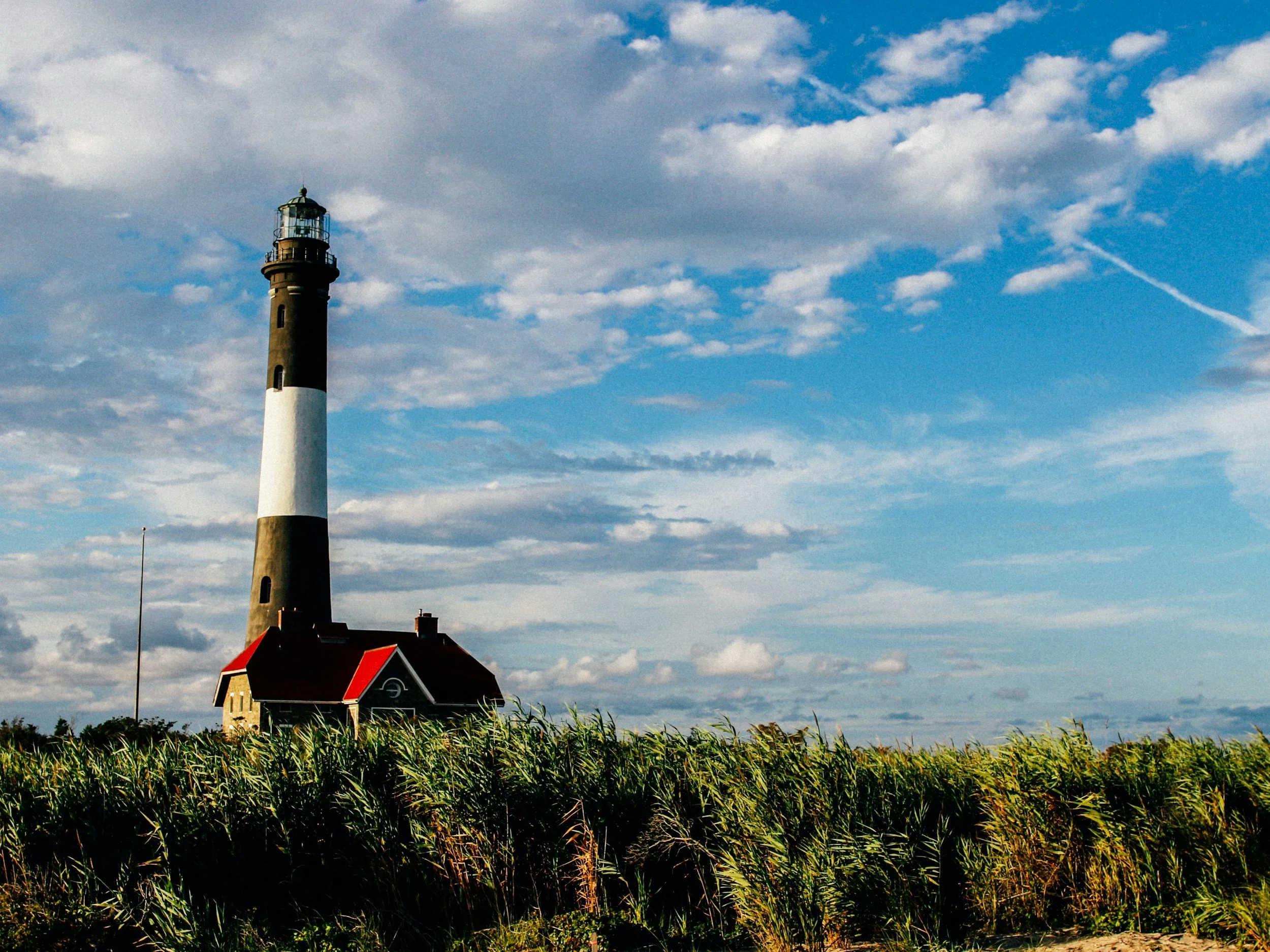
FIRE ISLAND NATIONAL SEASHORE-F.I.N.S.
6 miles – moderate – flat, some sand – PRIOR Registration and cellphone number required - CALL Sal, 631-235-2059, or E: sailingsals60@gmail.com. Join us for a walk at Fire Island National Seashore to the Lighthouse and beyond towards Atlantique; we’ll wind through quaint beach towns along streets, boardwalks and some beaches (tides permitting) before returning; sneakers will suffice for this hike. Take Robert Moses Causeway south to end; enter the traffic circle, take 2nd right towards Parking Field 5; meet at the east end of Field 5 near the boardwalk entrance. Heavy rain cancels, light rain does not. Optional lunch afterwards. Hike end time is approximate.

TERRELL RIVER / KALER'S POND PARKS
4-5.1 miles - PRIOR Registration and cellphone number required - CALL Sal, 631-235-2059, or E: sailingsals60@gmail.com. A moderately fast hike over gently varied terrain paralleling the river, opening to a picturesque beach with scenic views of Moriches Bay and Fire Island National Seashore; after hiking along the beach, we will return to the trails to complete the loop; hiking shoes recommended; bring ample water, snacks and a smile; binoculars/cameras for wildlife viewing optional. from L.I.E. Exit 68 or NY 27 Exit 58S, take William Floyd Parkway south to Montauk Hwy. (C.R. 80); turn left, and in 2.9 miles keep right to stay on Montauk Hwy.; continue another 2.1 miles to Kalers Pond Park parking lot, on left, opposite Terrell River Park. GPS: 1 Chet Swezey Rd, Center Moriches, NY 11934. No parking fee. Heavy rain cancels, light rain does not. Optional lunch afterwards. Hike end time is approximate.

COLD SPRING HARBOR OUT AND BACK
5.3 miles – fast – hilly - Info: Tammy, 631-896-1409, between 6-9pm. We’ll do the first few miles of the Nassau-Suffolk Greenbelt Trail by continuing past Route 108 to Stillwell Lane, then we’ll turn around and retrace our steps. This trail has some nice hills to make sure we get a great workout. This is not a beginner hike. Bring water and trail snacks, and a hiking pole is recommended. Heavy rain cancels, light rain does not; call or text the morning of hike if unsure. Directions: We’ll meet at the Nassau-Suffolk Greenbelt Trailhead on Harbor Rd. (NY25A), in the unpaved parking lot adjacent to the Cold Spring Harbor Library. Hike end time is approximate.

MARSH MARCH
around 11 miles - fast - varied - Info: Jeff, 631-902-3156, or e: jeffgreenberger@mac.com. See the summer fading in the rearview both in the woods and out in the wetlands, with our usual diet of forest tunnel walking nicely leavened by some miles on the scenic flanks of Flanders Bay. Could be buggy out in the Hubbard Marsh, so dope up - and bring plenty of water! Meet at the Spinney Road parking area on route 24 in Flanders - look for Spinney Rd Trail Parking on Google Maps; fast pace- we’re in it for the exercise; only one quick stop for snacks; inclement weather cancels, so call or text to be sure! Hike end time is approximate.

SANS SOUCI COUNTY PARK
4.5-5 miles – moderate - PRIOR Registration and cellphone number required - CALL or E: Sal, 631-235-2059, or sailingsals60@gmail.com. Explore several trails in the pine barrens of this county park, featuring the Sans Souci Lakes and abundant wildlife; bring water, snacks and a smile; hiking shoes recommended. Snow, heavy rain cancels, light rain does not; no restroom facilities available. Meet at the Bayport trailhead; from NY 27 Exit 50 eastbound or Exit 51 westbound, go south on Broadway Ave. to Montauk Hwy.; go left about 1/4 mile, and left again onto Lakeview Ave (Girl Scout Way), opposite Speedway Gas; Sans Souci Bayport trailhead sign will be on your left after about 1/4 mile); park on the park side and meet at park sign; No Fee. GPS: 468 Lakeview Ave, Bayport, NY 11705. Heavy rain cancels, light rain does not. Optional lunch afterwards. Hike end time is approximate.

GRACE ESTATE HISTORIC HIKE
approx. 5 miles - moderate pace - varied terrain - Info only: Rick, call or text (631) 275-8539, richardwhalen@optonline.net. Learn about the history of East Hampton’s Northwest Woods, site of the “Deserted Village” of Northwest. We will be hiking in the Grassy Hollow Preserve as well as the Grace Estate. We will visit the Van Scoy graveyard and historic site and Kirk’s Place on the shore of Northwest Harbor. Meet at the Northwest Schoolhouse plaque, Northwest Road ~1/4 mile south of Alewife Brook Road. Bring snacks, liquids & tick protection. Hike end time is approximate.

Fall BBQ
9:00 AM - 4:00 PM - Rain or Shine Bethpage State Park Picnic area Blue Bird Pavillion.
*** REGISTRATION REQUIRED***
(Register under Fall BBQ tab on LI Greenbelt Website.)
9:30 - 8 mile hike with leader Tammy
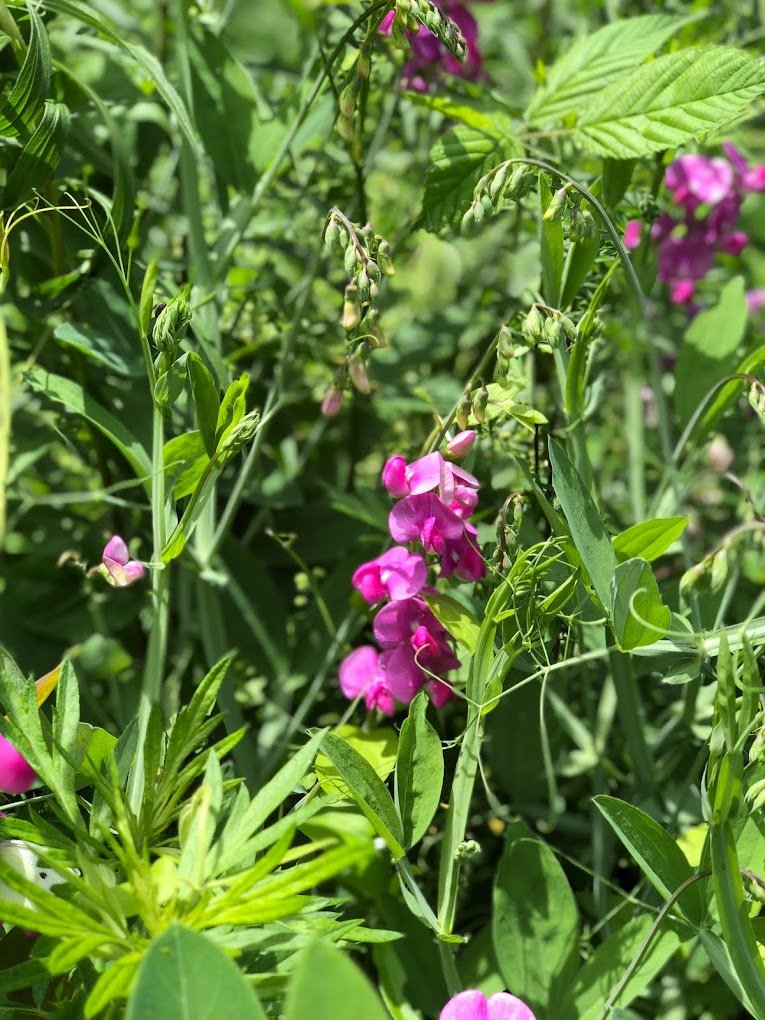
10:00 - 6 mile hike with Foraging and Plant Identification with leader Fran
10:30 - 4 mile moderate hike to get a good feel of Bethpage SP with Tom
11:15 - 3 mile easy hike for socializing and enjoying the Fall colors with Kathie

NISSEQUOGUE RIVER, & SUNKEN MEADOW PARKS
4.5-5.5 miles – moderate – varied to hilly – PRIOR Registration and cellphone number required - CALL or E: Sal, 631-235-2059, or sailingsals60@gmail.com. A moderately paced hike along the hilly bluffs of Sunken Meadow and the Nissequogue River features picturesque views of the Long Island Sound, and Connecticut. Bring water, snacks and a smile. Restrooms at Sunken Meadow and Nissequogue River Park have been open. Hiking shoes are recommended. Heavy rain cancels; light rain does not. Take Sunken Meadow Pkwy. north to Exit SM4E. Head east on Pulaski Rd. (which changes into Old Dock Rd.) At the 5th traffic light make a right onto St. Johnland Rd. After 1/2 mile, turn left into the Park, Possible parking fee. We will meet at the Charles & Helen Reichert Administration Building, Nissequogue River State Park, Kings Park, NY 11754. Heavy rain cancels, light rain does not. Optional lunch afterwards. Hike end time is approximate.

NAPEAGUE BEACH OCEAN HIKE
approx. 2.5 miles - moderate pace, but sandy (ocean beach) - Info only: Rick, call or text (631) 275-8539, richardwhalen@optonline.net. Early on a Sunday morning join us for a hike along the beautiful sandy shore of Napeague Beach. We’ll have the Atlantic Ocean on one side and the dunes of Napeague State Park on the other. Plus, there will be a special surprise at the turnaround point of the hike. Meet at the State beach access parking area, south side of Montauk Highway (Route 27), 3,800 feet east of Shipwreck Drive. Note early start time. Bring liquids. Hike end time is approximate.

BETHPAGE ST PARK RED & WHITE TRAILS
5-6 miles – fast – mainly flat - Info: Tammy, 631-896-1409, between 6-9pm. We’ll start on the Red Trail and pick up some of the White trail (aka the Nassau-Suffolk Greenbelt Trail) within the park. Bring water and trail snacks. Heavy rain cancels, light rain may not; call morning of hike if unsure. Directions: NY-135 exit 8, Powell Ave. Head east and make a quick left into the park towards the picnic area and polo field. Follow the road past the toll booth and head left into the picnic area parking lot. Parking kiosk by the restrooms: those 60+ can scan a NYS driver’s license for free parking slip; otherwise, $8 fee :( We’ll meet in the southeast corner of the lot, which is closest to the entrance. Hike end time is approximate.
CONNETQUOT RIVER STATE PARK PRESERVE
4-5 miles, moderate, flat - PRIOR Registration and cellphone number required. CALL or E: Sal, 631-235-2059, or sailingsals60@gmail.com. One of the crown jewels of the Long Island Greenbelt system, this preserve maintains 3473 acres of land & water for the protection & propagation of game birds, fish, animals, & 50 miles of trail through the park. Formerly a private sportsman's club, this lightly used area is a classic pine barrens system, featuring a canopy of pitch pine and several varieties of oak. The Connetquot River flows gently through the center of the park, affording opportunities to observe ospreys, herons, egrets, kingfishers, River Otter, & a host of other species. Near the entrance is a grist mill from the early 1700s & the large Sportsmen's Club, parts of which were built in the early 1800s. A mile north, a trout hatchery built over a century ago is still in operation. We will meet at Westbrook Sports Complex Ball Fields and follow the L.I. Trail to a catwalk under Sunrise Hwy and into Connetquot River State Park Preserve. After a rest stop at the Main House, we'll continue North on trails paralleling the river. We will visit the hatchery before continuing to Bunces Bridge, then head South to complete the loop. Bring ample water and a snack. There is no parking fee at Westbrook. GPS Address: 1 Wheeler Rd. Great River, NY 11739. Heavy rain cancels; light rain does not. Optional lunch afterwards. Hike end time is approximate.

HITHER WOODS LAUREL CANYON HIKE, MONTAUK
approx. 3 miles - moderate pace - some steep terrain - Info only: Rick, call or text (631) 275-8539, richardwhalen@optonline.net. Start your weekend with a short but somewhat hilly loop through the leafy interior of Hither Woods. The hike will climb Laurel Canyon to the scenic viewpoint known as Panorama. We will finish the hike past Midland Junction and the Lost Boulder. Meet at roadside shoulder parking on Navy Road, ~1/2 mile west of Navy Road Railroad crossing. Note early start time. Bring liquids & tick protection. Hike end time is approximate.
SANS SOUCI COUNTY PARK
4.5 to 5 miles – moderate - PRIOR Registration and cellphone number required. CALL or E: Sal, 631-235-2059, or sailingsals60@gmail.com. Explore several trails in the pine barrens of this county park, featuring the Sans Souci Lakes and abundant wildlife; bring water, snacks and a smile; hiking shoes recommended. Snow, heavy rain cancels, light rain does not; no restroom facilities available. Meet at the Bayport trailhead; from NY 27 Exit 50 eastbound or Exit 51 westbound, go south on Broadway Ave. to Montauk Hwy.; go left about 1/4 mile, and left again onto Lakeview Ave (Girl Scout Way), opposite Speedway Gas; Sans Souci Bayport trailhead sign will be on your left after about 1/4 mile); park on the park side and meet at park sign; No Fee. GPS: 468 Lakeview Ave, Bayport, NY 11705. Heavy rain cancels, light rain does not. Optional lunch afterwards. Hike end time is approximate.

TERRELL RIVER / KALER'S POND PARKS
4–5.1 miles - PRIOR Registration and cellphone number required - CALL Sal, 631-235-2059, or E: sailingsals60@gmail.com. A moderately fast hike over gently varied terrain paralleling the river, opening to a picturesque beach with scenic views of Moriches Bay and Fire Island National Seashore; after hiking along the beach, we will return to the trails to complete the loop; hiking shoes recommended; bring ample water, snacks and a smile; binoculars/cameras for wildlife viewing optional. from L.I.E. Exit 68 or NY 27 Exit 58S, take William Floyd Parkway south to Montauk Hwy. (C.R. 80); turn left, and in 2.9 miles keep right to stay on Montauk Hwy.; continue another 2.1 miles to Kalers Pond Park parking lot, on left, opposite Terrell River Park. GPS: 1 Chet Swezey Rd, Center Moriches, NY 11934. No parking fee. Heavy rain cancels, light rain does not. Optional lunch afterwards. Hike end time is approximate.
CAUMSETT JAUNT
7 miles - 600 ft Elevation Gain - Moderate Difficulty - 3 MPH pace - Call or Email: Mark, QuistAdventures@gmail.com, 516-672-9853. Come hike some forested trails in Caumsett that takes us along the perimeter of the park! We will meet in front of the Park Offices by the entrance station. We will be walking on a mix of uneven trails through the woods, unpaved roads and paved paths. There will be some steep hills along our path. Bring plenty of water, snacks and appropriate footwear. Heavy rain or snow cancels. If unsure, please contact me in the morning of the hike. There will be a fee to enter the park, please plan appropriately. Address: 25 Lloyd Harbor Road, Huntington, NY 11743. Hike end time is approximate.
SUNKEN MEADOW & BEYOND
approx. 12+ miles – Fast – Hills - Prior registration requested, text or call Fran, 631-806-5078. Come explore the wild beauty of Long Island’s North Shore! Our hike will wind along the shimmering Sound, through tidal marshes, and beside the banks of the Nissequogue. In the woods, we’ll tackle both Cardiac and Snake Hills—maybe more than once! Fast and strenuous pace. Meet at Field 3 by the bathrooms. Entry fee this time of year after 8am on weekdays, so don’t be late. Bring water and snacks and good spirits. Filtered water available at the Charles and Helen Reichert Administration building in Kings Park. Heavy rain cancels. Hike end time is approximate.
BAYARD CUTTING ARBORETUM
4.5-5 miles – PRIOR Registration and cellphone number required - CALL or E: Sal, 631-235-2059, or sailingsals60@gmail.com. Meet at the new Welcome Center/ Restrooms for a brisk hike in this South Shore hidden jewel encompassing 690 acres along the picturesque Connetquot River; bring water, snacks, and a smile; trail shoes recommended; heavy rain cancels, light rain does not; Take Southern State Pkwy. Exit 45E, continue east on Montauk Hwy. 1/2 mile to entrance on the right, or NY 27 to Connetquot Ave., turn south, to Montauk Hwy. and left to the Arboretum; GPS: 440 Montauk Hwy, Great River, NY 11739. Heavy rain cancels, light rain does not. Optional lunch and concert to follow. Hike end time is approximate.

COLD SPRING HARBOR OUT AND BACK
5.3 miles – fast – hilly - Info: Tammy, 631-896-1409, between 6-9pm. We’ll do the first few miles of the Nassau-Suffolk Greenbelt Trail by continuing past Route 108 to Stillwell Lane, then we’ll turn around and retrace our steps. This trail has some nice hills to make sure we get a great workout. This is not a beginner hike. Bring water and trail snacks, and a hiking pole is recommended. Heavy rain cancels, light rain does not; call or text the morning of hike if unsure. Directions: We’ll meet at the Nassau-Suffolk Greenbelt Trailhead on Harbor Rd. (NY25A), in the unpaved parking lot adjacent to the Cold Spring Harbor Library. Hike end time is approximate.

ELIZABETH MORTON NATIONAL WILDLIFE REFUGE
4 miles, PRIOR Registration and Cellphone number required - CALL or E: Sal, 631-235-2059, or sailingsals60@gmail.com. Slower paced, flat, wooded with some sand. Wildlife Viewing- Morton Refuge is an ideal spot for wildlife watching while hiking the Wild Birds Nature Trail and along the beach at low tide (hard packed sand). Wildlife have become acclimated to visitors and often go about their day without a second glance. Eastern wild turkeys, songbirds and chipmunks all can be seen along the wooded sections of the trail. Osprey can be seen flying overhead hunting for fish in the bay. In the winter, large groups of black ducks, bufflehead and common goldeneye can be seen floating in the bay. An elevated platform at the beach allows visitors an outstanding view of Little Peconic Bay, Noyack Bay and Jessup’s Neck Peninsula’s wildlife species. GPS: 2595 Noyack Road, Sag Harbor, NY 11963. Heavy rain cancels, light rain does not. Optional lunch afterwards. Carpool available from Sayville. Hike end time is approximate.

COLD SPRING HARBOR OUT AND BACK
5.3 miles – fast – hilly - Info: Tammy, 631-896-1409, between 6-9pm. We’ll do the first few miles of the Nassau-Suffolk Greenbelt Trail by continuing past Route 108 to Stillwell Lane, then we’ll turn around and retrace our steps. This trail has some nice hills to make sure we get a great workout. This is not a beginner hike. Bring water and trail snacks, and a hiking pole is recommended. Heavy rain cancels, light rain does not; call or text the morning of hike if unsure. Directions: We’ll meet at the Nassau-Suffolk Greenbelt Trailhead on Harbor Rd. (NY25A), in the unpaved parking lot adjacent to the Cold Spring Harbor Library. Hike end time is approximate.
HECKSCHER STATE PARK RAMBLE
two options 4.5 or 6 miles - moderate - varied/flat - Info: Quyen (Quinn), text 631-521-5103, qwpham@yahoo.com. Enjoy scenic hike around the park. We will walk along mostly wide trails and see the Camp site, Timber Point Marina and more. Rain cancels. Bring water, snacks, lunch and a chair for lunch break after hike. Meet in Field 6; park near a building on the Bayside. Address: Heckscher State Pkwy, East Islip, NY 11730. Park entrance is at the end of the Parkway. Follow signs to Field 6. ($8 parking fee or Empire Pass). Hike end time is approximate.
FIRE ISLAND NATIONAL SEASHORE-F.I.N.S.
6 miles – moderate – flat, some sand – PRIOR Registration and cellphone number required. CALL Sal, 631-235-2059, or E: sailingsals60@gmail.com. Join us for a walk at Fire Island National Seashore to the Lighthouse and beyond towards Atlantique; we’ll wind through quaint beach towns along streets, boardwalks and some beaches (tides permitting) before returning; sneakers will suffice for this hike. Take Robert Moses Causeway south to end; enter the traffic circle, take 2nd right towards Parking Field 5; meet at the east end of Field 5 near the boardwalk entrance. Heavy rain cancels, light rain does not. Optional lunch afterwards. Hike end time is approximate.

TRAILVIEW TO STILLWELL LN AND BACK
6.5 miles – fast – hilly - Info: Tammy, 631-896-1409, between 6-9pm. We will do an out-and-back from the Trailview Parking Lot to Stillwell Lane and back. Bring water and trail snacks. A hiking pole is recommended. Heavy rain cancels, light rain may limit the length of the hike; call morning of hike if unsure. Directions: I-495 (L.I.E.) Exit 44N. Merge onto NY-135 N toward Syosset. Take exit 14 E (Rte. 25 or Jericho Turnpike) toward Woodbury. Turn right onto 25. Continue to the Trailview Parking Lot on your left just east of the Stop and Shop. Hike end time is approximate.
COLD SPRING HARBOR MADNESS (OUT AND BACK)
9-10 miles - 1100 ft Elevation Gain - Strenuous Difficulty - 3+ MPH pace - Call or Email: Mark, QuistAdventures@gmail.com, 516-672-9853. Come hike through the hilly northern end of the Nassau-Suffolk Greenbelt Trail as we move through Cold Spring Harbor State Park, Uplands Farm Sanctuary, Trail View State Park and Stillwell Woods Preserve. We will loop back in Stillwell Woods and finish where we started. Water and food are essential here. Hiking footwear and trekking poles are recommended. We will meet in the parking lot of Cold Spring Harbor State Park, by the trailhead signage. Heavy rain or snow cancels. If following a period of rain in previous days, we might alter hike length for a safer trip. If unsure of the conditions, contact me prior to the hike. Address: 95 Harbor Road, Cold Spring Harbor NY 11724. Hike end time is approximate.
TERRELL RIVER / KALER'S POND PARKS
4–5.1 miles. PRIOR Registration and Cellphone number required. CALL Sal, 631-235-2059, or E: sailingsals60@gmail.com. A moderately fast hike over gently varied terrain paralleling the river, opening to a picturesque beach with scenic views of Moriches Bay and Fire Island National Seashore; after hiking along the beach, we will return to the trails to complete the loop; hiking shoes recommended; bring ample water, snacks and a smile; binoculars/cameras for wildlife viewing optional. from L.I.E. Exit 68 or NY 27 Exit 58S, take William Floyd Parkway south to Montauk Hwy. (C.R. 80); turn left, and in 2.9 miles keep right to stay on Montauk Hwy.; continue another 2.1 miles to Kalers Pond Park parking lot, on left, opposite Terrell River Park. GPS: 1 Chet Swezey Rd, Center Moriches, NY 11934. No parking fee. Heavy rain cancels, light rain does not. Optional lunch afterwards. Hike end time is approximate.

NISSEQUOGUE RIVER & SUNKEN MEADOW PARKS
4.5-5.5 miles – moderate – varied to hilly – PRIOR Registration and Cellphone number required. CALL or E: Sal, 631-235-2059, or sailingsals60@gmail.com. A moderately paced hike along the hilly bluffs of Sunken Meadow and the Nissequogue River features picturesque views of the Long Island Sound, and Connecticut. Bring water, snacks and a smile. Restrooms at Sunken Meadow and Nissequogue River Park have been open. Hiking shoes are recommended. Heavy rain cancels; light rain does not. Take Sunken Meadow Pkwy. north to Exit SM4E. Head east on Pulaski Rd. (which changes into Old Dock Rd.) At the 5th traffic light make a right onto St. Johnland Rd. After 1/2 mile, turn left into the Park, Possible parking fee. We will meet at the Charles & Helen Reichert Administration Building, Nissequogue River State Park, Kings Park, NY 11754. Heavy rain cancels, light rain does not. Optional lunch afterwards. Hike end time is approximate.

STONY HILL HIKE, AMAGANSETT
4 miles - moderate pace - varied terrain - Info only: Rick, call or text (631) 275-8539, richardwhalen@optonline.net. Celebrate Independence Day with a summer ramble through fields and woods. Peconic Land Trust’s Deborah Light Preserve and Stony Hill Preserve features farmland with wonderful soils and a beautiful shady forest, which form a delightful backdrop to a morning hike. Meet on road shoulder of Abraham’s Path, about 1/4 mile north of Town Lane, Amagansett. Note early start time. Bring liquids & tick protection. Hike end time is approximate.

WEST HILLS WANDER
4 miles, 8 miles or 10 mile options - 1350 ft Elevation Gain (Full 10 miles) - Moderate to Strenuous Difficulty - 3+ MPH pace - Call or Email: Mark, QuistAdventures@gmail.com, 516-672-9853. Come hike the hills of Huntington! The first four miles will be exploring the Jayne’s Hill area with an option to drop off after, followed by four miles exploring the western side of the park with an option to drop off after eight miles. Finally, we will finish with a loop through the southern preserve section, which is by far the hilliest. We will meet in the parking lot next to the large dog park. A surplus of water and snacks are strongly recommended to combat high temperatures. Pants are highly recommended. Heavy rain cancels. If unsure, please contact me on the morning of the hike. Address : 220 Sweet Hollow Road, Melville NY 11747. Hike end time is approximate.
SANS SOUCI COUNTY PARK
4.5 to 5 miles – moderate – PRIOR registration required and cellphone number requested. CALL or E: Sal, 631-235-2059, or sailingsals60@gmail.com. Explore several trails in the pine barrens of this county park, featuring the Sans Souci Lakes and abundant wildlife; bring water, snacks and a smile. Hiking shoes recommended; heavy rain cancels, light rain does not; no restroom facilities available; meet at the Bayport trailhead; from NY 27 Exit 50 eastbound or Exit 51 westbound, go south on Broadway Ave. to Montauk Hwy.; go left about 1/4 mile, and left again onto Lakeview Ave (Girl Scout Way), opposite Speedway Gas; Sans Souci Bayport trailhead sign will be on your left after about 1/4 mile); park on the park side and meet at park sign; GPS: 468 Lakeview Ave, Bayport, NY 11705. Heavy rain cancels, light rain does not. Optional lunch afterwards. Hike end time is approximate.
CAUMSETT JAUNT
7 miles - 600 ft Elevation Gain - Moderate Difficulty - 3 MPH pace - Call or Email: Mark, QuistAdventures@gmail.com, 516-672-9853. Come hike some forested trails in Caumsett that takes us along the perimeter of the park! We will meet in front of the Park Offices by the entrance station. We will be walking on a mix of uneven trails through the woods, unpaved roads and paved paths. There will be some steep hills along our path. Bring plenty of water, snacks and appropriate footwear. Heavy rain or snow cancels. If unsure, please contact me on the morning of the hike. Address: 25 Lloyd Harbor Road, Huntington, NY 11743. Hike end time is approximate.
BETHPAGE ST PARK RED & WHITE TRAILS
5-6 miles – fast – mainly flat. Info: Tammy, 631-896-1409, between 6-9 pm. We’ll start on the Red Trail and pick up some of the White trail (aka the Nassau-Suffolk Greenbelt Trail) within the park. Bring water and trail snacks. Heavy rain cancels, light rain may not; call morning of hike if unsure. Directions: NY-135 exit 8, Powell Ave. Head east and make a quick left into the park towards the picnic area and polo field. Follow the road past the toll booth and head left into the picnic area parking lot. No parking fee after 5pm. We’ll meet in the southeast corner of the lot, which is closest to the entrance. Hike end time is approximate.
ELIZABETH MORTON NATIONAL WILDLIFE REFUGE
4-5 miles - Slower paced -flat - wooded with some sand - PRIOR registration required and cellphone number requested. CALL or E: Sal, 631-235-2059, or sailingsals60@gmail.com. Wildlife Viewing- Morton Refuge is an ideal spot for wildlife watching while hiking the Wild Birds Nature Trail and along the beach at low tide (hard packed sand). Wildlife have become acclimated to visitors and often go about their day without a second glance. Eastern wild turkeys, songbirds and chipmunks all can be seen along the wooded sections of the trail. Osprey can be seen flying overhead hunting for fish in the bay. In the winter, large groups of black ducks, bufflehead and common goldeneye can be seen floating in the bay. An elevated platform at the beach allows visitors an outstanding view of Little Peconic Bay, Noyack Bay and Jessup’s Neck Peninsula’s wildlife species. GPS: 2595 Noyack Road, Sag Harbor, NY 11963. Heavy rain cancels, light rain does not. Optional lunch afterwards. Carpool available from Sayville. Hike end time is approximate.
COLD SPRING HARBOR OUT AND BACK
5.3 miles – fast – hilly. Info: Tammy, 631-896-1409, between 6-9pm. We’ll do the first few miles of the Nassau-Suffolk Greenbelt Trail by continuing past Route 108 to Stillwell Lane, then we’ll turn around and retrace our steps. This trail has some nice hills to make sure we get a great workout. This is not a beginner hike. Bring water and trail snacks, and a hiking pole is recommended. Heavy rain cancels, light rain does not; call or text the morning of hike if unsure. Directions: We’ll meet at the Nassau-Suffolk Greenbelt Trailhead on Harbor Rd. (NY25A), in the unpaved parking lot adjacent to the Cold Spring Harbor Library. Hike end time is approximate.
BAYARD CUTTING ARBORETUM WALK
4.5 to 5 miles – moderate – flat – PRIOR registration required and cellphone number requested. CALL or E: Sal, 631-235-2059, or sailingsals60@gmail.com. Meet at the new Welcome Center/ Restrooms for a brisk hike in this South Shore hidden jewel encompassing 690 acres along the picturesque Connetquot River; bring water, snacks, and a smile; trail shoes recommended; heavy rain cancels, light rain does not; Take Southern State Pkwy. Exit 45E, continue east on Montauk Hwy. 1/2 mile to entrance on the right, or NY 27 to Connetquot Ave., turn south, to Montauk Hwy. and left to the Arboretum; GPS: 440 Montauk Hwy, Great River, NY 11739. Optional lunch and Sunday Concert afterwards. Hike end time is approximate.
MILLER’S GROUND HIKE, EAST HAMPTON
Approx. 6 miles - moderate pace - varied to hilly terrain - Info only: Rick, call or text (631) 275-8539, richardwhalen@optonline.net. Explore the Miller’s Ground woods, including Toyland, on this rambling hike through the high forested hills at Miller’s Ground, west of Route 114 and north of the East Hampton Airport. Hopefully we will catch the mountain laurel in bloom. Along the way see if you can identify the Sleeping Lion. Meet at the Northwest Path trailhead, on the East Hampton-Sag Harbor Turnpike (Route 114) just south of Edwards Hole Road. Bring snacks, liquids & tick protection. Hike end time is approximate.
MARSH MARCH
Approx. 11 miles - fast - varied - Info: Jeff: 631-902-3156 or jeffgreenberger@mac.com. See the summer starting both in the woods and out in the wetlands, with our usual diet of forest tunnel walking nicely leavened by some miles on the scenic flanks of Flanders Bay. Could be buggy out in the Hubbard Marsh, so dope up! Meet at the Spinney Road parking area on Route 24 in Flanders - look for Spinney Rd Trail Parking on Google Maps. Bring water; fast pace - we're in it for the exercise, only one quick snack stop; inclement weather cancels, so call or text to be sure! Hike end time is approximate.
SANS SOUCI COUNTY PARK
4.5 to 5 miles – moderate – PRIOR registration required and cellphone number requested. CALL or E: Sal, 631-235-2059, or sailingsals60@gmail.com. Explore several trails in the pine barrens of this county park, featuring the Sans Souci Lakes and abundant wildlife; bring water, snacks and a smile. Hiking shoes recommended; heavy rain cancels, light rain does not; no restroom facilities available; meet at the Bayport trailhead; from NY 27 Exit 50 eastbound or Exit 51 westbound, go south on Broadway Ave. to Montauk Hwy.; go left about 1/4 mile, and left again onto Lakeview Ave (Girl Scout Way), opposite Speedway Gas; Sans Souci Bayport trailhead sign will be on your left after about 1/4 mile); park on the park side and meet at park sign; GPS: 468 Lakeview Ave, Bayport, NY 11705. Heavy rain cancels, light rain does not. Optional lunch afterwards. Hike end time is approximate.
BETHPAGE Ballroom BLITZ
4 to 5 miles - 225 ft Elevation Gain - Moderate Difficulty – 3 MPH pace - Call or Email: Mark, QuistAdventures@gmail.com, 516-672-9853. Come celebrate National Trails Day and hike through Bethpage on some of the shared trails! We will be meeting in the picnic parking lot by the bathrooms. Bring water and snacks! Heavy rain cancels. If unsure, please contact me in the morning of the hike. Hike end time is approximate.